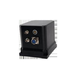
As100-100 Small-Size High-Precision Mems Accelerometer SPI Bus Output UAV Flight Control Inertial Navigation

|
... Bus Output UAV Flight Control Inertial Navigation Introduction: Gyro100-1000 is a micromechanical gyroscope with high precision and small volume based on MEMS technology. It adopts small volume ceramic package and integrates temperature compensation ......
Wuxi Bewis Sensing Technology LLC
|
Fixed Wing UAV Iaser Strapdown Inertial Navigation System with dimensions 185mm×139.5mm×110mm

|
KsINS-J105D laser strapdown inertial navigation system product description: The KsINS-J105D laser strapdown inertial navigation system is a small-volume, high-precision laser strapdown inertial navigation system. It has the advantages of small size, light ......
Xi'an Kacise Optronics Co.,Ltd.
|
FG-900M UAV USE FIBER OPTIC INERTIAL NAVIGATION SYSTEM FAST ALIGN LESS THAN ONE MINUTE

|
...UAV USE FIBER OPTIC INERTIAL NAVIGATION SYSTEM FAST ALIGN LESS THAN ONE MINUTE Overview The tactical FOG inertial measurement unit which has the functions of angular rate and acceleration input/output,error compensation,etc.is composed of inertial sensor assembly,electric circuits and chassis.it can provide angular rate and acceleration for flight control system and stabilized control......
QINGDAO THUNDSEA MARINE TECHNOLOGY CO.,LTD
|
High Accuracy Ships Inertial Navigation System Widely Used Mems Inertial Navigation System

|
...cost-effective fiber optic inertial/satellite integrated navigation system that can be widely used in navigation, control, and measurement fields, such as high-precision vehicle-mounted systems and medium-to-long endurance unmanned aerial vehicles (UAVs)....
Wuhan Liocrebif Technology Co., Ltd
|
GNSS Inertial Navigation Guidance Attitude Measurement System for Uav Navigation Gyroscope

|
Product Description INS500 fiber-optic integrated navigation system (hereinafter referred to as "inertial navigation") is based on high-precision closed-loop fiber-optic gyroscope, accelerometer and high-end GNSS receiving board, and is realized through ......
Shenzhen Fire Power Control Technology Co., LTD
|
UNIVO UBTS700Y Integrated Inertial Navigation System for Ship Control and UAV Navigation

|
#detail_decorate_root .magic-0{border-bottom-style:solid;border-bottom-color:#53647a;font-family:Roboto;font-size:24px;color:#53647a;font-style:normal;border-bottom-width:2px;padding-top:8px;padding-bottom:4px}#detail_decorate_root .magic-1{width:750px}#......
Beijing Universe Technologies Co., Ltd.
|
WT-43-RD-4G RTK high precision module Integrated 4G module and inertial navigation can be used for accurate positioning of urban tunnels and canyons

|
Product Description: Scope of Application: GIS collection Handheld terminal Displacement monitoring Base station It can be used for accurate positioning of urban tunnels and canyons Communication positioning field Positioning and measurement in complex ......
Shenzhen Anzewei Technology Co., Ltd
|
Merak-70S Single-Axis Tactical Sagnac Optical Gyroscope For Inertial Navigation System Customized

|
FOG(Merak-70S) This high-precision single-axis Fiber Optic Gyroscope (FOG) utilizes the Sagnac optical effect with all-digital closed-loop detection technology, providing real-time angular velocity output at 4kHz or higher via serial interface. The compact......
CSSC Star&Inertia Technology co.,ltd.
|
920m Range High Integration UAV Mapping System ARS-1000 4.5kg Drone LiDAR Survey

|
...integration UAV Mapping System ARS-1000 with 15mm@150m accuracy ARS-1000 UAV Mapping System is a Riegl LiDAR based system. It is developed and built by Wuhan Hi-Cloud Technology Co., Ltd. The system integrates different sensors like high-precision laser, high-definition camera, GPS, MEMS inertial navigation and storage control......
Wuhan Hi-Cloud Technology Co.,Ltd
|
GS-100E UAV LiDAR Scanning System With Integrated Multispectral Camera Geosun

|
UAV LiDAR Scanning System with Integrated Multispectral Camera Geosun GS-100E LiDAR Scanning System Application for 3D Surveying and Mapping GS-100E is a UAV measurement system independently developed by Geosun Navigation. It highly integrates laser scanner, GNSS satellite positioning system, INS inertial navigation......
Wuhan Geosun Navigation Technology Co., Ltd.
|
