| Sign In | Join Free | My chinacomputerparts.com |
|
| Sign In | Join Free | My chinacomputerparts.com |
|
| Categories | Point Cloud Processing Software |
|---|---|
| Brand Name: | Geosun |
| Model Number: | gAirHawk 5.0 |
| Company Info. |
| Wuhan Geosun Navigation Technology Co., Ltd. |
| Verified Supplier |
| View Contact Details |
| Product List |
PointCloudCreater-gAirHawk 5.0 Software Introduction
All-in-One Point Cloud Pre-Processing Software with Built-in
Trajectory Calculation
High-Precision | Self-Developed | Free Trial Available
gAirHawk 5.0 is a powerful LiDAR data acquisition and pre-processing software independently developed by Geosun Navigation. Designed for use with Geosun’s LiDAR scanning systems, it integrates trajectory calculation and point cloud processing into a streamlined workflow, improving both efficiency and accuracy in 3D mapping projects.
This software supports:
Real-time configuration and monitoring of LiDAR and GNSS/INS acquisition systems
Intelligent import and decoding of raw LiDAR data
Trajectory solution, point cloud generation, optimization, and export
Seamless compatibility with Geosun UAV and handheld platforms
Key Features of gAirHawk 5.0
Smart Raw Data Import
Automatically recognizes and loads LiDAR and navigation data from
Geosun systems.
Built-in Coordinate Systems
Four default coordinate system options for rapid setup and accurate
alignment.
Point Cloud Optimization
Includes noise filtering, strip alignment, and data cleaning tools
to enhance quality.
One-Click Processing
Easily start or stop trajectory calculation and point cloud
generation with a single command.
Free Software for Testing-Document Overview:Trial Software Information
Achievable High Precision

The Interface of gAirhawk

Flight area selection

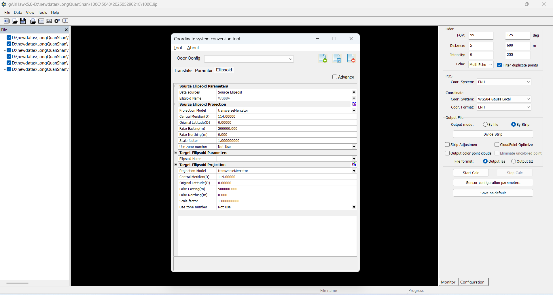
Coordinate system
Calculate point cloud
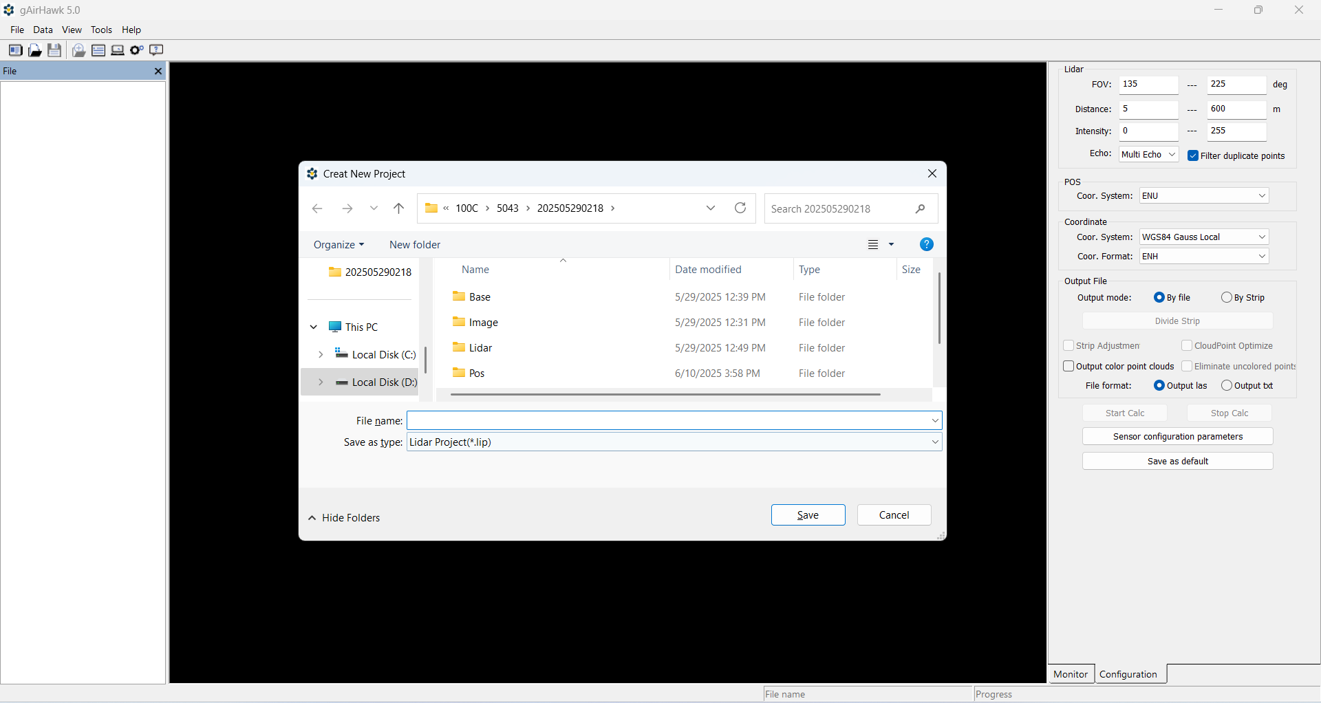
Adding raw data

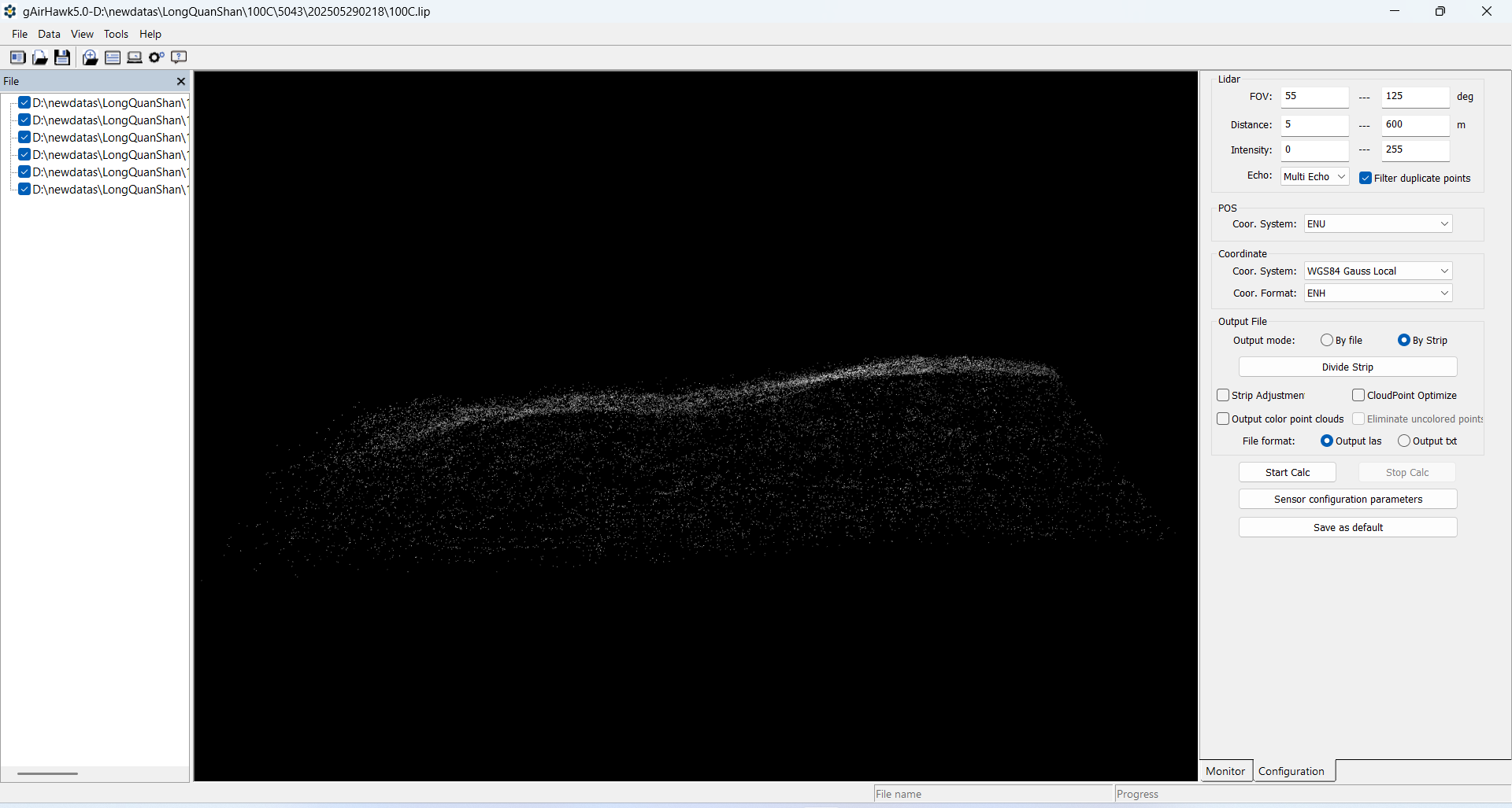
Point Cloud Rendering


|
