| Sign In | Join Free | My chinacomputerparts.com |
|
| Sign In | Join Free | My chinacomputerparts.com |
|
| Categories | LiDAR Mobile Mapping System |
|---|---|
| Brand Name: | Hi-Cloud |
| Model Number: | HiScan-Z High-precision LiDAR Mobile Mapping System |
| Certification: | ISO, others upon the requests |
| Place of Origin: | China |
| MOQ: | 1 |
| Price: | Negotiable |
| Payment Terms: | T/T |
| Supply Ability: | 5 sets/month |
| Delivery Time: | 20 working days |
| Packaging Details: | Transport Case |
| Number of Scanners: | 1 |
| Range Measurement: | 119m |
| Laser Frequency: | 1,010,000 points/s |
| Range Accuracy: | 1mm@50m |
| Scan FoV: | 360 ° |
| Panoramic Camera Resolution: | 30M pixels |
119m range HiScan-Z High-precision LiDAR Mobile Mapping System 0.0088° angular resolution and 1mm@50m range accuracy
HiScan-Z high-precision laser mobile measurement system is a Z+F
LiDAR based surveying and mapping equipment which developed by
Wuhan Hi-Cloud Technology Co., Ltd.. The system highly integrates
sensors such as 2D laser scanning equipment, satellite positioning
module, inertial navigation unit, odometer, 360° panoramic camera,
assembly control module and high-performance computers. It is
encapsulated in a rigid platform, can be easily installed on cars,
ships or other mobile carriers. During the high-speed movement of
the carrier, it can quickly obtain high-precision positioning and
orientation data, high-density point clouds and high-definition
continuous panoramic image data.
The system can easily complete the production and processing of
vector map data, street view data and geographic data, and is
widely used in basic topographic surveying and mapping, urban
municipal components/garden census, traffic survey and design,
traffic information census, street view map service, digital city
and other fields.
Specification:
HiScan-Z High-precision LiDAR Mobile Mapping System
| Items | Parameters |
| Number of Scanners | 1 |
| Range Measurement | 119 m |
| Laser Frequency | 1,010,000 points/ s |
| Range Accuracy | 0.9mm@50m |
| Angle Measurement Resolution | 0.0088 ° |
| Scan FoV | 360 ° |
| Panoramic Camera | Ladybug/HD Camera (optional ) |
| Panoramic Camera Resolution | 30M / 75M pixels |
| Accuracy | 5cm@100m |
| Scan Speed | Max.200 scans/s |
Features:
Application:
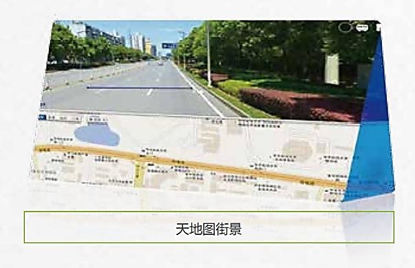
1. Internet street view map
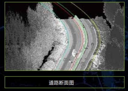
2. Basic topographic mapping

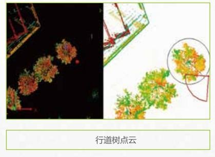
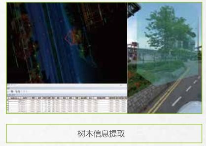
3. Urban municipal component survey

4. Urban landscaping survey


5. Highway survey and intelligent transportation


6. Digital 3D city


|
